Asien
Indien
Steckbrief
- Hauptstadt
- Neu-Delhi
- Kontinent
- Asien
- Staatsform
- Parlamentarische Bundesrepublik
- Sprachen
- Hindi, Bengalisch, Marathi
- Währung
- Indische Rupie (INR)
- Vorwahl
- +91
- Domain
- .in
- Zeitzone (Hauptstadt)
- UTC+5
- Fahrseite
- Linksverkehr
Sprachen: Hindi 43,6 % · Bengalisch 8 % · Marathi 6,9 % · Telugu 6,7 % · Tamil 5,7 % · Gujarati 4,6 % · Urdu 4,2 % · Kannada 3,6 %
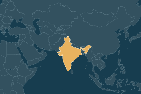
6 Nachbarländer · Grenze in km
Millionenstädte
Wirtschaft
Woher kommt das BIP? · 2024
- Landwirtschaft16,4 %
- Industrie24,5 %
- Dienstleistungen49,9 %
Wofür wird es ausgegeben? · 2024
- Konsum der Haushalte61,5 %
- Staatsausgaben10,1 %
- Investitionen29,6 %
- Lagerbestände3 %
- Exporte21,2 %
- Importe-23,5 %
in % des BIP · Importe zählen negativ
Wichtigste Exporte · 2023
- Erdölprodukte
- Medikamente
- Diamanten
- Sendetechnik und Handys
- Kleidung
Geht vor allem nach
Wichtigste Importe
- Rohöl
- Gold
- Kohle
- Erdgas
- Computerchips
Kommt vor allem aus
Bodenschätze & Rohstoffe
Landwirtschaft: die 10 größten Erzeugnisse
nach Menge (Tonnen)
Menschen
Altersstruktur
- unter 15 Jahre24,2 %
- 15 bis 64 Jahre68,4 %
- 65 und älter7,4 %
Stadt und Land
- in Städten35,7 %
- auf dem Land64,3 %
Im Vergleich mit den Nachbarn
Alle Zahlen
dieselben Werte wie in Higher LowerZahlen & Fakten
| Einwohner | 1,5 Mrd. | Platz 1 von 195 | 2025 |
|---|---|---|---|
| Fläche | 3,3 Mio. km² | Platz 7 von 194 | 2024 |
| Einwohner pro km² | 488 pro km² | Platz 17 von 194 | 2024 |
| Wirtschaftsleistung (BIP) | 3,96 Bio. US$ | Platz 6 von 193 | 2025 |
| BIP pro Kopf | 2.703 US$ | Platz 147 von 193 | 2025 |
| Lebenserwartung | 72,2 Jahre | Platz 116 von 195 | 2024 |
| Glücks-Wert (World Happiness Report) | 4,54 von 10 | Platz 115 von 146 | 2026 |
| Menschliche Entwicklung (HDI) | 0,685 von 1 | Platz 130 von 192 | 2023 |
| Kinder pro Frau | 1,96 Kinder | Platz 99 von 195 | 2024 |
| Medianalter | 30,1 Jahre | Platz 106 von 193 | 2025 |
| Anteil über 65-Jährige | 7,4 % | Platz 99 von 195 | 2025 |
| Anteil unter 15-Jährige | 24,2 % | Platz 99 von 195 | 2025 |
| Anteil Stadtbevölkerung | 35,7 % | Platz 161 von 195 | 2025 |
| Internetnutzer | 70 % | Platz 122 von 193 | 2025 |
| Handyverträge pro 100 Einwohner | 79 pro 100 | Platz 152 von 195 | 2024 |
| Waldanteil | 24,4 % | Platz 112 von 194 | 2024 |
| Anteil Ackerland | 51,7 % | Platz 6 von 191 | 2024 |
| CO₂ pro Kopf | 2,2 t pro Jahr | Platz 99 von 186 | 2024 |
| Strom aus Erneuerbaren | 19,1 % | Platz 116 von 190 | 2021 |
| Arbeitslosenquote | 4,2 % | Platz 111 von 179 | 2025 |
| Ärzte pro 1.000 Einwohner | 0,72 pro 1.000 | Platz 128 von 189 | 2020 |
| Krankenhausbetten pro 1.000 Einwohner | 1,6 pro 1.000 | Platz 101 von 153 | 2021 |
| Alter der Mutter beim ersten Kind | 21,2 Jahre | Platz 89 von 129 | 2019 |
| Ausgaben für Bildung | 4,1 % des BIP | Platz 96 von 180 | 2022 |
| Exporte | 22 % des BIP | Platz 126 von 173 | 2025 |
| Militärausgaben | 2 % des BIP | Platz 78 von 164 | 2024 |
| Ungleichheit (Gini-Index) | 25,5 von 100 | Platz 142 von 145 | 2022 |
| Flugpassagiere pro Jahr | 180 Mio. | Platz 4 von 152 | 2023 |
| Höchster Punkt | 8.586 mHöchster Punkt: Kanchenjunga | Platz 4 von 191 | Quelle |
| Mittlere Höhe des Landes | 160 m | Platz 137 von 162 | Quelle |
| Küstenlänge | 7.000 kmZu Fuß bei 30 km am Tag: ≈ 233 Tage | Platz 18 von 194 | Quelle |
| Länge der Landgrenzen | 13.888 km | Platz 4 von 194 | Quelle |
| Höhe der Hauptstadt | 210 m | Platz 70 von 195 | Quelle |
| Durchschnittstemperatur | 24,9 °C | Platz 73 von 196 | Quelle |
| Einwohner der Hauptstadt (Ballungsraum) | 32,9 Mio.Ballungsraum New Delhi | Platz 2 von 117 | 2023 |
Zum Spaß
| Anzahl Nachbarländer | 6 Länder | Platz 23 von 197 | Quelle |
|---|---|---|---|
| Anzahl Amtssprachen | 3 Sprachen | Platz 13 von 197 | Quelle |
| Olympia-Medaillen (alle Zeiten) | 41 Medaillen | Platz 52 von 138 | 2026 |
| Nobelpreisträger | 12 Personen | Platz 20 von 79 | 2025 |
| Durchschnittsgröße der Männer | 165 cm | Platz 71 von 88 | Quelle |
| Autos pro 1.000 Einwohner | 38 pro 1.000 | Platz 147 von 171 | 2024 |
| Bier pro Kopf | 2 Liter pro Jahr≈ 0,2 Kästen (20 × 0,5 l) pro Person und Jahr | Platz 60 von 61 | 2015 |
| Wein pro Kopf | 0 Liter reiner Alkohol | Platz 165 von 186 | 2019 |
| Alkohol pro Kopf | 3,1 Liter reiner Alkohol | Platz 108 von 186 | 2019 |
| Tee pro Kopf | 0,33 kg pro Jahr≈ 0,5 Tassen am Tag (2 g pro Tasse) | Platz 29 von 54 | Quelle |
| Milch pro Kopf | 85 kg pro Jahr≈ 1,2 Gläser (0,2 l) am Tag | Platz 94 von 175 | 2013 |
| Fleisch pro Kopf | 6,1 kg pro Jahr≈ 0,8 Schnitzel (150 g) pro Woche | Platz 162 von 164 | 2020 |
| Kaffee-Ernte | 332.848 Tonnen | Platz 9 von 36 | Quelle |
| Anteil Raucher | 21,8 % | Platz 53 von 166 | 2025 |
| Starkes Übergewicht (Erwachsene) | 3,9 % | Platz 186 von 189 | 2016 |
| Flughäfen und Flugplätze | 315 Stück | Platz 23 von 190 | 2025 |
| Länge des Schienennetzes | 65.554 km1,6-mal um den Äquator | Platz 4 von 133 | 2014 |
| Milliardäre | 229 Personen | Platz 3 von 74 | 2026 |
| Anzahl Inseln | 1.382 Inseln | Platz 23 von 95 | Quelle |
| Atomreaktoren in Betrieb | 20 Reaktoren | Platz 6 von 34 | Quelle |
| Festnetz-Internet pro 100 Einwohner | 2 pro 100 | Platz 172 von 192 | 2022 |
Kurioses
| Buchstaben im deutschen Ländernamen | 6 Buchstaben„Indien“ | Platz 151 von 197 | Quelle |
|---|---|---|---|
| Fläche in Saarländern | 1.279,3 Saarländer | Platz 7 von 194 | 2024 |
| Hubschrauber-Landeplätze | 289 Stück | Platz 12 von 144 | 2025 |
| Handelsschiffe unter eigener Flagge | 1.859 Schiffe | Platz 14 von 165 | 2023 |
| McDonald’s-Filialen | 757 Filialen1 Filiale auf 1.933.818 Menschen | Platz 12 von 92 | 2025 |
| Preis eines Big Mac | 2,45 US$ | Platz 50 von 52 | 2026 |
GeoGuessr
Street View in GeoGuessrFahrseite: linksFür dieses Land gibt es noch keinen GeoGuessr-Steckbrief.
Quizzes
0 Quizzes mit IndienNoch keine freigeschalteten Quizzes mit Indien.
Auch dabei: Higher Lower – welches Land hat mehr Einwohner, Bier, Küste …?
Wirtschaft, Handel, Rohstoffe, Sprachen, Staatsform und Grenzen: CIA World Factbook (Datensatz), gemeinfrei, eigene Übersetzung. Zahlen: wie bei Higher Lower (Weltbank, CIA, Wikipedia u. a. – Jahr anklicken für die Quelle). Karten: Natural Earth und die Ebenen der Atlas-Quizzes. Alle Quellen